
Above Top: Slide Show from Sears-Kay, Agua Fria National Monument, Gisela, and Pyramid Point Field Trips with Scott Wood.
Above Bottom: Drone Video from Chaparrel Pines and Portal Field Trip Descriptions of Past Field Trips

What's New in 2026
Meetings will resume in September.
While Meetings are free and open to the public, membership in AAS is required for participation on Hikes, Field Trips and the Goat Camp Excavation.
Goat Camp Excavation: Pending permit renewal, the tentative schedule for the Fall is September 27, October 11 & 25, November 8 & 22, and December 13, all Saturdays. Watch for updates. Goat Camp Information, Excavation, and Lab Opportunities

About our Chapter
The Rim Country Chapter of AAS is located in Payson, AZ, at the base of the Mogollon Rim. Meetings generally include a guest speaker presenting an archaeological related subject. Refreshments are served. An outing to an archaeology site is normally scheduled for the afternoon following the general meeting. The RCC, under the guidance of Archaeologist Scott Wood, is participating in the excavation of the local Goat Camp Prehistoric Ruins Site. The completion of the excavation project will likely take several years, (Note: participation in the excavation, after meeting outings, and field trips is open only to current members of the Arizona Archaeological Society.)
Meeting Time and Place:
Meetings will be held in the morning at 10:00 am on the third Saturday of each month (except summer) unless otherwise specified. Rim Country Chapter will be meeting at the Payson Public Library in the Rumsey Park complex at 328 N McLane Road, Payson Arizona. Upon entering the Library foyer, turn right and go all the way to the end of the hall, last door on the left. The door opens at 9.
Membership:
Chapter Membership ensures that you will receive emails alerting you to meetings, field trips, and other events. Contact Rim Country Chapter treasurer Dennis DuBose for membership information. You can join the Rim Country chapter of AAS with a "Single" or "Family" membership. If you are already a member through a different chapter, you can add the Rim Country chapter to your membership by selecting "Single" or "Family" after "Dual Chapter". Memberships expire on 12/31. Membership Form
Fun Things to Do:

Ritual Enclosures, Prehistoric Forts and Hilltop Sites Drones and Videos
A group of geologists, archaeologists, and AAS members created the below guide for people who would like to enjoy the outdoors on Agua Fria National Monument. It's a 12 page, illustrated guide to a incredible area with a river at the end:
Geology, Archaeology, and History Guide to Badger Springs Trail Guide and Companion Video
If above link doesn't work try this:
Geology, Archaeology, and History Guide to Badger Springs Trail Companion Video
Volunteer Archaeology Work at: Goat Camp Ruin
Archaeological Sites to Visit (hours may vary): Shoofly Ruin Besh ba Gowah Ruin
Verde Valley Sites Agua Fria National Monument (site brochures at bottom)
Tonto National Monument (big file) Black Canyon Journey Through Time
Sears-Kay Site Sears-Kay Drone Arizona Archaeological Sites
YouTubes: Drone Videos of Archaeological Sites Rim County Museum Sharlot Hall Museum
Archaeological Institute of America (AIA) Heard Museum SAR AAHS Pueblo Grande Museum Amerind Crow Canyon
Arizona State Museum Archaeology Southwest Grand Canyon NPS Museum of Northern Arizona
2025/26 Speakers:
| Date | Speaker | Topic |
|---|---|---|
| Sept. 20, 2025 | Rick Mathews |
Smith Family Preserve Petroglyph Site |
| Oct. 18, 2025 | Mike & JJ Golio | Documenting Precontact Hilltop Enclosures of Central Arizona |
| Nov. 15, 2025 | Christine and Joel Clarkson |
Virtually Explore the Great Murals of Baja, Mexico |
| Dec. 20, 2025 | Amy Marymor |
Newberry Cave, CA & the Split Twig Figurine Complex: A Ritual Connection across the Archaic Southwest. |
| Jan. 17, 2026 | Aaron Wright | Following Their Footsteps: Indigenous Geography and the Anza Expedition of 1775-1776 |
| Feb. 21, 2026 | Bryan Hughes |
Rattlesnakes! Fact & Fiction |
| Mar. 21, 2026 |
|
No Meeting |
| April 18, 2026 |
Robert Frutos |
Ancient Whispers: Rock Art of Northern Arizona and Beyond, Rock Art from a Native American Point of View. |
| May | No meeting until September | |
2024/2025 Chapter Officers:
| President |
Sharon DuBose |
| Vice President | Chuck Eby |
| Treasurer | |
| Secretary | Carol Taska Smith |
| Board Member |
Brent Reed |
| Board Member | Marianne Connors |
| Board Member | Chuck Howell |
| Chapter Advisor/Goat Camp Excavation | Scott Wood |
| Rim Chapter/Goat Camp Webmaster | jj Golio |
Past Activities:
April 18: Robert Frutos, Rim Country Chapter Member and author of Ancient Whisperings: Rock Art of Northern Arizona spoke on Arizona Petroglyphs. Petroglyphs were inspired by the energies and powers that reflected a way of life at the time by the people who lived them. By imprinting petroglyphs and pictographs on stone, they shared, captured, and revealed their inspirations, life events, hunting activities, agricultural occurrences, significant astrological cycles, as well as, spiritual and ceremonial experiences. Moreover, they were all created in very unique and special places, special in ways most modern people are perhaps not even not aware of.
March 8: Field Trip to 10 Mile Draw and 7 Mile Canyon. These two significant Petroglyph sites are near Snowflake, Arizona. The trip was led by Robert Frutos, author of Ancient Whisperings: Rock Art of Northern Arizona and our Speaker at the April 18 Meeting.
March 6: Botany Walk at Tonto National Monument Becky Settje, President of the Tonto Basin Chapter of the Arizona Native Plant Society, invited AAS Members to participate on a native plant hiking tour at the Monument. So many Rim Country Chapter Members showed up that they completely filled one of the three groups on the tour. The tour explored plant habitats of both upland slopes and down in the shade of a riparian watercourse. If you wish to join the Arizona Native Plant Society, visit www.aznps. After the Botany Walk, some Field Trippers walked up to the Tonto National Monument Lower Ruin.
February 21: Bryan Hughes spoke on Rattlesnakes! Fact & Fiction. Meeting Attendees learned how to stay safe in the outdoors, what to do if you see a rattlesnake, and most importantly, what not to do. Few animals spawn mythology and stories like they do. In working with thousands of rattlesnakes and people in Arizona, Bryan has heard it all. He'll go through the top bits of popular snake mythology, why people believe it, and get to the real story. If you fear rattlesnakes, as most people do, you’ll get tools to help feel better about it. While this presentation is about snakes, there is much to learn about how our own minds can lead us astray. Participants will also learn to stay safe in the outdoors, what to do if you see a rattlesnake, and most importantly, what not to do. Live rattlesnakes and a gila monster from all around Arizona will be on display (safely behind locked glass). Learn everything you've ever wanted to know about our most misunderstood native wildlife.
Bryan Hughes is a herpetologist from Cave Creek, Arizona. He is the owner of Rattlesnake Solutions, a private business dedicated to the conservation and understanding of rattlesnakes and the safety of people who encounter them. He regularly appears in the media and as a speaker at educational events. Current projects include research on rattlesnake populations on urban islands, advances in rattlesnake conflict mitigation, and the development of data-driven public safety messaging.
A field trip to Gisela followed the meeting.
February 7: Field trip to Spur Cross: This was a day trip to Spur Cross Ranch Preservation Area near Cave Creek, Arizona. Spur Cross is one of the Maricopa County Regional Parks. Ranger Kevin Smith gave a guided tour including petroglyph and other archaeological sites. Spur Cross is a small valley with a permanent creek, groomed trails, both prehistoric ruins and historic ranch ruins.
January 23: Trip to Hematite House. This stone, mortar, and plaster cliff dwelling gets its name from the deposits of red and yellow hematite iron-oxide mineral that are associated with it. It was presumably built by the Salado Culture around 700 years ago. They probably traded these bright pigments around the region. It is located in Tonto National Forest. We also visited a petroglyph site.
January 17: Aaron Wright presented Following Their Footsteps: Indigenous Geography and the Anza Expedition of 1775-1776. Spanish colonialism succeeded in part by co-opting Indigenous knowledge, resources, and infrastructure—including methods for navigating difficult and dangerous terrain unfamiliar to the colonizers. A prime example is the 1775–1776 overland expedition from the Sonoran missions to the Pacific Coast led by Captain Juan Bautista de Anza, launched to claim and colonize the San Francisco Bay, then a remote harbor in Alta California critical to Spain’s expanding presence in the Americas. In recognition of the expedition’s 250th anniversary, this presentation shares findings from recent archaeological investigations that reveal how the expedition relied on an established Indigenous trail network to successfully traverse the Sonoran Desert—arguably the most challenging segment of the five-month, 1,800-mile journey.
Aaron M. Wright is a preservation anthropologist with Archaeology Southwest, a nonprofit organization based in Tucson, Arizona. He specializes in the cultural landscapes of southern and western Arizona, focusing on the Huhugam and Patayan archaeological traditions. Wright’s scholarship and service have earned multiple honors, including most recently the Arizona Archaeological Society’s Professional Archaeologist Award (2023) and the American Rock Art Research Association’s Castleton Award (2025). His book-length publications include Leaving Mesa Verde: Peril and Change in the Thirteenth-Century Southwest (2010, co-edited with Tim Kohler and Mark Varien), the award-winning Religion on the Rocks: Hohokam Rock Art, Ritual Practice, and Social Transformation (2014), The Great Bend of the Gila: Contemporary Native American Connections to an Ancestral Landscape (2016, with Maren Hopkins), and his most recent work, Sacred Southwestern Landscapes: Archaeologies of Religious Ecology (2024).
After the meeting there was a five mile hike along a jeep trail with 700 feet elevation gain to a Petroglyph Site near Payson.
January 1-5: Trip to Las Cruces, New Mexico.
December 20: Amy Marymor spoke on Newberry Cave, CA & the Split Twig Figurine Complex: A Ritual Connection across the Archaic Southwest.
We also had a Christmas Potluck Meeting and an after-meeting hike to Chaparral Pines Ruin in Payson.
December 6: Field Trip to petroglyph site near Dixie Mine.
November 15: Christine and Joel Clarkson will spoke on Virtually Explore the Great Murals of Baja, Mexico Their presentation was a virtual journey to these remote murals, starting in San Ignacio, at the base of the Sierra de San Francisco mountains. Live tours are generally guided by vaqueros, taking participants by mule or horseback.
There was a post-meeting field trip to a petroglyph site south of Pine as well.
October 18: Mike & JJ Golio presented Documenting Pre-Contact Hilltop Enclosure of Central Arizona This included drone photos and videos of some of the sites. JJ and Mike Golio have been interested in precontact ritual enclosures located on hilltops, ridgetops, and mesa tops since they visited their first one over 40 years ago. Along with large public architecture on high ground, their current investigations also include smaller types of non-habitation architecture such as eagle traps and anchorite sites. Anchorite sites are located on nearly inaccessible hilltops and rocky eminences.
In the early nineties, the Golios presented their work at the Pecos Conference. Since 2019, they’ve visited and documented over 130 of these ritual enclosures. After becoming a licensed drone pilot, Mike began taking aerial videos of the sites. He also creates 3D site models which provide more detail of the ritual enclosure architecture. The Golios have been recording drone videos of hilltop enclosures, writing site reports, taking photographs, and sharing their data with archaeologists including Hoski Schaafsma, Scotts Wood, and Justin Mortenson.
Their work allows archaeologists to study sites without the necessity of driving, hiking and climbing to each site. The Golios were coauthors with Hoski on his 2023 and 2024 Pecos Conference presentations, and his 2024 Tri-National Sonoran Desert Symposium presentation. Justin used their work for a poster at the 2023 Pecos Conference. This is an ongoing project and the Golio's presentation will include their basic work and newer results that include initial data analysis of the characteristics and features of ritual enclosures across regions of AZ previously occupied by groups of the Central Arizona Tradition.
Some of their videos can be viewed on the YouTube Golio Endeavors chan nel. Examples are separated into categories on https://Golio.net. The Golios have collaborated on papers and presentations for the Salado Conference, Pecos Conference, AAS, San Diego Rock Art Papers, ARARA, and URARA. They worked with Ron Kern, geologist and Desert Foothills member, to create "Geology, Archaeology, and History Guide to Badger Springs Trail". The guide is available on the AAS website under the Member-Only Research Pubs section
October 18 After meeting hike: To the Payson Solstice Solar Site which we visited a few months ago. Something new was found: A line of three small boulders stringing along in a straight line about 100 yards long from the Solar Solstice boulder at the top of the hill in the direction of the Summer Solstice sunset each have a spiral on them.
October 2-5: Smith Family Preserve Utah, coordinated by Diane Seago & Sharon DuBose. Field Trip to Smith Family Archaeological Preserve in SE Utah located on 200 acres with over 240 panels of Native American rock art in near pristine condition from Paleo-Indian, Archaic, Fremont, and Historic time periods dating back almost 5,000 years. Led by Diane Seago.
September 20: Rick Mathews spoke on the Smith Family Preserve petroglyph site near Payson, Utah. The 196 acre preserve protects more than 200 prehistoric petroglyph panels plus other archaeological features from multiple occupations from as long ago as 13,000 BCE. He spoke through a Zoom online video connection at the Payson Library. RCC is sponsoring a Field Trip to the Smith Family Preserve and other sites in Utah in October.
May 3: Day Hike on Five Mile Canyon near Snowflake featuring petroglyphs. Richard Gonsalves, President of Agave House Chapter, will lead the hikes. The canyon name refers to their distance from Snowflake, not the length of the hike.
April 26-27: Hopi Villages Field Trip, organized by Dale Bellisfield, a Hopi guided tour of some parts of the lesser known places of the Hopitutskwa: Taaawa Park Petroglyphs, Blue Canyon, Coal Mine Canyon. Hopi People of the Land
March 23: A day-hike to the Archer Site near Payson, led by Scott Wood. The site contains petroglyphs, Apache gowas (wikiup stone rings), and other archaeology. One petroglyph is an archer. It appears that Rim Country Chapter has not sponsored a visit to this site since May, 2018.
March 15: Archaeologist Scott Wood spoke on One N'de at a Time; Apache History and Archaeology on the Tonto National Forest. From the 1500s to the 1870s, most of the area that later became the Tonto National Forest was occupied by the Dilzhé’e, the people known today as the Tonto Apache after the ancient Uto-Aztecan name for the area. Related groups who would become known as the White Mountain and San Carlos Apache occupied the easternmost portions. The presentation will talk about the history of the Tonto Apache from their arrival in central Arizona to the present day and explore Apache archaeological sites and rock art.
Scott Wood is retired 10 years from being the Tonto National Forest Archaeologist for 40 years, but he is currently active with the Goat Camp Excavation, Friends of Tonto Forest, Friends of Agua Fria, and numerous speaking engagements.
After meeting Hike led by Chris Tezloff and Scott Wood to Hickcox Pueblo. drone video.
February 15: Hoski Schaafsma's presentation, Hilltop Enclosures and Hohokam Influencers in the Arizona Uplands, explores enigmatic hilltop enclosures, hundreds of which crown hills in the central Arizona physiographic transition zone. Initially, many of these structures were given names like ‘Indian Fort’ implying defensive fortification, which prompted the concept of a central Arizona filled with tribal warfare. This idea of region wide conflict got stamped on the landscape of central Arizona. However, a growing body of work is substantiating the idea that these hilltop structures are not defensive in nature, rather they appear to have been built for ceremonial purposes; ceremonial practices that were held commonly across numerous cultural areas including the Patayan, Cohonina, Prescott, Sinagua, Western Mogollon, and Hohokam. The sites that represent this shared ceremonial complex include decorative architecture, associated retreats or anchorites, and other features indicative of ritual activities. Temporally, the construction and use of these ritual structures coincide with a northern expansion of the Hohokam cultural sphere to the north of the Phoenix Basin; their use terminates with the retraction of the Hohokam cultural sphere. We present a theory that hilltop enclosures were the result of an emergent ritual activity initiated by the admixture of Hohokam culture with the cultures that were present to the north of the Phoenix Basin, resulting in three hundred years of cooperation throughout much of central Arizona. Other contributors to this research are Justin Mortensen, Mike Golio, JJ Golio, and Teresa Rodrigues.
Bio: Project Director with Desert Archaeology, Inc., B.A. Philosophy, St. John’s College, M.S., Plant Biology, 2003, Arizona State University, With Desert since 2019 Hoski has over 35 years of archaeological project experience, and has worked in Arizona, New Mexico, Utah, Colorado, Northern California, Hawaii, the Mariana Islands and central Sweden. Areas of expertise include ethnobotany, anthropogenically modified landscapes and ancient agricultural practices. His research interests include human interaction with the landscape, and the philosophic permutations thereof.
Chris Tetzloff led an outing to Thirteen Turtles after the meeting. After that Mike led an outing to O'Neill.
January 18: Ryan Arp spoke on Oversized Structures within Hohokam Villages in the Phoenix Basin. Ryan presented updates on recently excavated Hohokam sites in the Phoenix Basin including Massera, Cashion, and Villa Buena. He focused on the archaeology of Pre-Classic period Hohokam oversized structures that were encountered within portions of prehistoric Hohokam villages. He reviewed excavation approaches and documentation of these structures and discuss commonalities in form, assemblages, and ranges of activities that may have occurred in and around these structures. The talk presented updates on recent contributions to the larger narratives surrounding the pre-Classic Hohokam.
Ryan Arp, MA, RPA is Vice President, Archaeology with Tempe-based WSP, and is currently collaborating with a team of archaeologists on projects at large prehistoric village sites as well as on regional CRM (Cultural Resource Management) projects throughout the U.S. Southwest (UT, NV, CA, NM, TX, and AZ).
January 18: After meeting hike to a Payson area archaeological site. The site is near a Payson Town Trail with a short uphill hike off trail with low brush. The site consists of two boulders split apart from each other naturally almost exactly in line with the Winter Solstice sunrise, which is about 118 degrees off of North towards Southeast in Payson. This natural configuration perhaps attracted the attention of Prehistoric Americans to identify this as a special place. The sunrise side of the Back Boulder has a large spiral petroglyph which a few minutes after sunrise had its north side edge marked by two sun light wedges for at least ten minutes with the spiral itself still shaded by the Front Boulder. The opposite side of the Back Boulder has a petroglyph whose upper corner appears to mark the line of view along a cleft atop the boulder in the direction about 118 degrees across the axis of the two boulders towards the sun rising over a low ridge opposite. Someone placed two smaller rocks in the cleft aligned in the direction of the Winter Solstice sunrise. David Young says they were not there earlier in the week. There is a smaller boulder a few feet away that has a petroglyph panel that can be viewed if you are facing the rising sun. The panel appears to contain sky cloud symbols and astronomical symbols.
January 11-12: Tucson Area: We visited the Los Morteros Conservation Area, a well-preserved Hohokam village site named for the numerous mortar holes found in volcanic rocks throughout the site, which also includes a ballcourt, remnants of pit houses, and trash mounds. Then we went to the Picture Rocks Petroglyphs site at the Redemptorist Renewal Center. This site, a hill beside a wash, has several hundred petroglyph images. The main cluster has petroglyphs that interact with sun shadows at solstice and equinox events. On the second day, our November Speaker Janine Hernbrode guided a visit to the private Cocoraque Ranch. Here there is a large hill of volcanic boulders with many petroglyph panels around the base and scattered all the way to the summit, including some bell rock boulders. A short walk across a prehistoric plaza is a cluster of bell rocks accessible without climbing. Janine will provided us with wooden mallets, which we used to “test” the boulders ringing sounds.
December 21: Paleoanthropologist Geoffrey A. Clark (G. A. Clark) spoke on Human Evolution in Deep Time & the Dawn of Archaeology. Perhaps the greatest story ever told is how humans became the last and sole surviving member of our lineage, the hominins – modern humans, extinct human species and all our immediate ancestors. The human career is a long one, extending back at least 6 million years and marked by a number of major transitions, including the shift to life on the ground, habitual bipedality, increases in brain size and social complexity, the first technologies, and the emergence of language.
Untangling the complicated relationships amongst these transitions is the principal task of paleoanthropology and, over the past 25 years, there have been many new and exciting discoveries and the picture changes – is changing now – with every one of them. Professor Clark will discuss the human paleontology and archaeology of our lineage in ‘deep time’ – the past 4 million years. He will present the broad outlines of these transitions, but it should be kept in mind that full consensus is – so far – beyond our reach. How we became the highly intelligent, technologically sophisticated, socially complex animals we are today will probably never be known with certainty, but with every new discovery the picture changes a little, or a lot, and hopefully becomes a little clearer.
Clark is Regents’ Professor Emeritus in the School of Human Evolution & Social Change at Arizona State University. He is the author, co-author, or editor of more than 300 articles, notes, reviews and comments, and 12 monographs and books on human biological and cultural evolution in ‘deep time.’ He seeks to promote Western Science as a conceptual framework for describing and explaining the experiential world. Clark has done fieldwork in Arizona, France, Spain, Cyprus, Turkey, Sudan and Jordan.
David Young led an after meeting hike to the Oxbow Mine petroglyph site.
December 7: Day hike to Zulu Mine Ruin and nearby Petroglyphs. An all day hike near Payson including a 4 mile loop hike with elevation gain up to 400 feet to see scattered petroglyphs. The terrain is rocky and brushy with no trail.
November 17: JJ Golio led an all day hike SW of Payson was to a series of petroglyph clusters called Zulu. We went from cluster to cluster in a big loop. The hike was about 2 miles off trail with a 600 ft elevation gain.
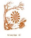
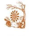
November 16: After-Meeting Hike to the East Verde River Pictographs, also called Thirteen Turtles. Part of this rock art is the inspiration for the Rim Country Chapter logo. Photo of main panel is above.
November 16: Janine Hernbrode spoke on Bell Rocks and Megaphones. Janine has spent a lifetime in an avocational pursuit of observing, recording, and researching rock art. Ms. Hernbrode is a graduate of the University of Arizona. Arizona has numerous Hohokam petroglyph sites. These sites often contain boulders that produce a bell-like sound when struck as well as other intriguing sound phenomena. Accompanying the acoustical characteristics are petroglyphs that may represent the belief system of their creators. The largest recorded petroglyph site contains over 140 bell rocks that show clear evidence of use during pre-contact times. These bell rocks resonated at a wide range of frequencies spanning three musical octaves and are positioned so that musical interaction is possible. Additional research shows that some bell rocks are portable and that others were rubbed, not struck, to produce sound. It was also discovered that certain features in the landscape produce a megaphone-like amplification of sound. These sound amplifying boulders are all marked with similar imagery. Janine Hernbrode is the leader and lead researcher of an archaeological team that gathers and records data about rock imagery for public agencies in south central Arizona. She has authored numerous journal publications in the field of rock art and has a national reputation in this field. Her research collaboration with Dr Peter Boyle was recognized by the Society of American Archaeology with the Crabtree Award, given annually for outstanding contributions to Archaeology by avocational archaeologists.
October 19: After-Meeting Hike to the Way Cool Site, a site with lots of Chert. Way Cool also has some petroglyphs, cupules, and boulder metates. Meeting Speaker Kellam Throgmorton joined this hike.
October 19: Kellam J. Throgmorton, Assistant Professor, Department of Anthropology, Northern Arizona University spoke about Chert , his current research focus. Chert, is the type of rock most commonly used by prehistoric peoples around the world to make sharp tools or weapon points. Commonly in the US it is called “flint.” Common Chert generally originates as nodules in limestone. Technically, Flint is Chert originating as nodules in Chalk, a kind of limestone. Other kinds of Chert are Opal, Agate, Jasper, Chalcedony, Onyx, and more.
September 29: Field Trip led by Richard Gonsalves to some petroglyph sites in 5-Mile Canyon. It is on private land and normally closed to the public.
September 21: After meeting outing to Vista Acres.
September 21: Richard Gonsalves spoke on Emerging Stories in Petroglyphs. Richard, President of AAS Agave House Chapter (Heber-Overgaard), was early on a serious photographer and he was interested in petroglyphs. He was concerned about graffiti, vandalism, and theft, so, he began to use photography to preserve the petroglyphs. He was curious about their meaning. He found some recurring patterns in different locations and concluded that they must have meant something to somebody. He wondered about what that meaning was. He has maintained an open mind including many possibilities and has come up with some compelling interpretations. Some of these are controversial. He was not satisfied with mere conjecture but has documented theories with intriguing photos that lead one to wonder beyond conventional wisdom. He shows uncanny similarities of many petroglyphs to early Chinese character symbols. He presents astronomical connections of petroglyphs to constellations and historic astronomical events as well as viewing markers for solstices and equinoxes. And he considers connections between US Southwest petroglyphs to Mesoamerican imagery. Every scientist should be curious, open to doubt about standard interpretations, since all scientific progress begins when someone questions what is “known.”
May 9-11: Field Trip to Zuni. Over the three-day experience, we will meet first with Zuni archaeologist Kenny Bowekaty, and enjoy hearing the Zuni migration story, have an orientation walk through the village, and visit beautiful frescoes in the old church. The next day, we venture with Kenny to an ancient petroglyph site, and see a different style of petroglyphs. The last day, we hike up El Morro to see the pueblos on top, and the petroglyphs and historic inscriptions on the cliff face below. After the El Morro hike, we return to Zuni and enjoy the Zuni Festival.
May 5: Outing to Azatlan, a very large and significant Hohokam pithouse community. The site is mostly unexcavated. It is part of an extensive complex of Hohokam villages that extend north along the Verde from its confluence with the Salt River near Ft. McDowell. Due to the rather vast extent of the site, our approximate 3-4 hour timeframe for the hike allowed us to only see a sampling of the cultural features at Azatlan: large trash mounds, ball courts, roasting pits, and a prehistoric canal. The hike was guided by retired Tonto National Forest archaeologist Scott Wood. His interpretation of the site was fascinating, informative, and as his talks always are, colorful and fun as well!
April 20: Evelyn Billo, President of the Northern Arizona Chapter of AAS, and Robert Mark presented With Beauty Around: Canyon del Muerto Rock Art Documentation Project. These sites are within the beautiful Canyon de Chelly National Monument on the Navajo Reservation near Chinle in Northeast Arizona. The rock imagery is mostly pictographs, but there are also some interesting petroglyphs. Many are in alcoves that are very hard to access, and not, in general, on the tours given by the park. The park Service approved this presentation but requested that specific locations not be shown or given. The team has documented 150 of the 300 known sites.
A Navajo prayer ends: “with beauty all around, may I walk.” Canyon de Chelly National Monument in the heart of Navajo country has beauty in the alcoves, on the cliffs, and with every landscape view. The two main canyons and their tributaries revealed Ancestral Puebloan images, traditional Navajo depictions, and historic scenes and inscriptions that provided an ideal setting to make new discoveries and overcome challenges. Highlights from 1999-2002 documentation includes panoramic and enhanced photography, hidden rock art gems, flash floods, and radiocarbon dates of storage cyst mortar over various pictograph designs.
Evelyn Billo and her husband, Robert Mark are retired Physical Scientists from the United States Geological Survey, who now specialize in using modern technology to document petroglyph and pictograph sites. Evelyn founded Rupestrian CyberServices (RCS www.rupestrian.com) in 1997 to assist land managers and professional archaeologists with baseline documentation of rock art sites, and to encourage conservation of rock imagery, geoglyphs and other fragile archaeological resources.
She has served in many volunteer positions including past President of the American Rock Art Research Association and acting president of the Northern Chapter of the Arizona Archaeological Society. Evelyn and Bob are Research Associates at the Museum of Northern Arizona, Conservation Lands Stewards for City of Flagstaff Open Space Preserves, and 2022 recipients of the Governors Heritage Preservation Honor Award as Arizona Site Stewards.
You can see an animated computer model of Rim Country Chapter’s own logo Pictograph often called “Thirteen Turtles” which has been set up by Robert Mark at the link here …
https://sketchfab.com/3d-models/e-verde-pictograph-panel-a2de44fa3542463d8ce43f3efc521451
When it is open, click and hold on the image to move it around to view from different directions.
April 7: Field Trip to Spanish Ruin, led by Pam Cissik. Spanish Ruin is a large precontact hilltop enclosure near Payson on the edge of a high cliff, with extensive often high walls and a number of rooms. Some boulder metates are nearby. Hard hike with substantial elevation gain. Great views. The local name Spanish Ruins is a misnomer as it is not related to Spanish activity in Arizona.
Site Description by retired Tonto Nationa Forest Archaeologist, Scott Wood: "Spanish Fort is an intriguing ruin. Obviously neither Spanish nor a fort, it belongs to a class of structures we call ritual enclosures. Ritual enclosures appear to have been a cultural phenomenon of the Hohokam-related Central Arizona Tradition. Based on ethnographic research with the Southern Tribes and Hopi, they appear to have been used for a particular set of ceremonial activities. Difficult to date because they rarely contain artifacts, they appear to have been built and used between about 850 and 1070 AD. They are found throughout central Arizona from Burro Creek in the west to San Carlos in the east and from Wupatki in the north to Gila Bend and Dudleyville in the South.
They are found in high, difficult to access places and usually consist of substantial rubble core walls enclosing empty space, though they occasionally have one or more small rooms associated with them. Sometimes, that empty enclosed space is divided in half by an interior wall, like Spanish Fort. They come in various shapes and sizes - round, rectangular, oval, and irregular and frequently merely take the form of the contour around the top of a hill. No two are exactly alike.
After these structures fell out of use around 1070 most do not appear to have ever been used again. However, many were located in what would later become strategic positions and were reoccupied in the mid 1100s or during the Great Drought (1275-1300) and rebuilt into fortified residences. Sears-Kay Ruin near Carefree is a classic example of such a re-occupation in the mid 1100s.
There is still a lot to learn about these perplexing structures. Archaeologists in the SW have only just recently begun to take an active interest in finding, inventorying, and classifying them. Hopefully, in a few more years we will know a lot more about them and their place in the Hohokam societies of central Arizona. For more information on Spanish Ruins, and hilltop enclosure sites in general, follow these YouTube links:"
https://www.youtube.com/watch?v=mhUzfUAHhdg&t=31shttps://www.youtube.com/watch?v=jZBglwio__E&t=13s
March 16: R. E. Burillo presented on Below and Beyond Perry Mesa: The Archaeology of the Greater West Verde Area, Central Arizona. He discussed a survey of 3,200 acres of a largely unstudied area extending north from Cave Creek between Perry Mesa and the Verde River basin on behalf of the Tonto National Forest. The results included re-recording and new discoveries of entire pueblo communities that challenge the existing models of settlement, agriculture, and regional exchange within the greater Verde River region. Initial Formative settlement is associated with the Central Arizona Tradition and shows strong similarities to settlement in the Cave Creek area. Settlement increased gradually until around A.D. 1275 when there was a sharp increase in population, corresponding both culturally and temporally to the Perry Mesa Tradition. During both periods, the region maintained multidirectional cultural ties, with both Hohokam buff wares and northern white wares on Central Arizona Tradition sites, and both Hopi Yellow wares and Salado polychromes on Perry Mesa Tradition sites.
February 17: Archaeologist Thatcher Seltzer-Rogers of the New Mexico office of Archaeological Studies spoke on The Joyce Well Site. This site is in the remote boot heel of New Mexico, within the Gray Ranch, a huge spread whose owners continue to exercise careful control over its archaeological and natural resources. The site consists of a single-story pueblo of about 200 rooms. Habitation peaked between AD 1200 and 1400. A portion of the site was excavated in 1963 and a large-scale investigation of the site and surrounding region including a ball court was done in 1999 and 2000. Analysis includes plant remains, skeletal material, ball courts, ritual performance, archaeomagnetic dating, and comparison with the Animas Phase and Paquime (Casas Grandes) further south in Chihuahua, Mexico.
After the Meeting Scott Wood led a pre-excavation-season tour of the Goat Camp excavation. The between-season coverings were still be in place.
January 20: Allen Dart presented on Southwest Rock Calendars and Ancient Time Pieces. He discussed petroglyphs at Picture Rocks, the architecture of the “Great House” at Arizona's Casa Grande Ruins, and other archaeological evidence of ancient southwestern astronomy and calendrical reckoning, and interpret how these discoveries may have related to prehistoric American rituals.
December 16: Holiday celebration. Our chapter provided a meat plaƩer of assortment of salami, sausages, cheese, olives, crackers and fruit, veggies and of course lots of Christmas cookies and other goodies. Leigh Marymor presented on Western Message Petroglyphs. Western Message Petroglyphs are historical faux-Indian petroglyph panels spread across eight Western US states, including Arizona. These panels appear to have been made with a metal tool by a single as yet unknown individual along wagon road and railway routes overlooking towns involved in boom time mining and with some association with Mormon settlements, all made during the late 1800s. Origins and interpretations are explored.
December 3: Fig Springs Petroglyphs (near New River), led by Brent Reed
November 18: Gary Huckleberry, a geoarchaeologist, presented Ancient Water Management in the Arizona Desert. Huckleberry has done research on Chimu earthen work water conveyance structures in the Chicama Valley of north-coastal Peru as well as Hohokam water management in Arizona. Arizona has a long history of people managing water for agriculture and human consumption. Evidence for ancient water management is found across the state and includes canals, reservoirs, and wells. The earliest irrigation canals and reservoirs thus far identified are in the Tucson area and date to around 1500 and 500 BCE, respectively. Through time, canal systems expanded in size, culminating in the impressive network of channels built by the Hohokam (450-1450 CE) along the lower Salt and middle Gila rivers. Gary Huckleberry will review the diversity of evidence, focusing on archaeological discoveries made in the Sonoran Desert region of central and southern Arizona, and discuss what lessons we might gain by studying these ancient features with respect to today’s water challenges. Gary Huckleberry is an independent consultant and adjunct researcher at the University of Arizona who specializes in soils, landforms, and archaeology.
November 11: Chavez Pass Pueblo and Petroglyphs (South of Meteor Crater), led by Brent Reed.
October 21: Rich Lange presented on 13,000 Years of Migrations In and Around Rock Art Ranch, Northwestern Arizona. The AAS publication The Arizona Archaeologist Issue Number 45 of the same title, co-authored by Rich Lange, will be published soon. All paid-up renewed members for 2024 will be eligible to receive a free copy.
October 7: Elden Pueblo and other Flagstaff Area Sites, led by Peter Pilles
September 16: Clissene Lewis presented on The Yavapai Journey. She is a tribal member of the Fort McDowell Yavapai Nation and willprovide a presentation that will focus on learning about the history and culture of her Yavapai People with an emphasis on the Fort McDowell Indian Community. The Yavapai People have had a long arduous journey and have overcome many obstacles over the years. This presentation is an opportunity to dialogue with other communities, to bring an awareness of a broken past, and to share the unique government to government relationship between Indian Tribes and the U.S Government. Her presentation is illustrated with many historical photographs and is drawn from a mix of family, tribal, and non-tribal sources and includes some surprising stories and facts.
May 27: Aaron Wright of Southwest Archaeology spoke on Ancestral Yuman Ceramics: Problems and Prospects. Research into the Ancestral Yuman World—better known as the Patayan archaeological tradition—is nearly a century in the making, but we still have a poor grasp of it relative to other cultural traditions of the North American Southwest. Chronological troubles and impediments are primarily to blame. The Patayan ceramic typology is the principal basis on which archaeologists date Ancestral Yuman sites and material, but studies have consistently shown that the chronology associated with it is inaccurate. This talk reviews the many problems and outlines fruitful ways forward with a case study from the lower Gila River.
May 21: Field Trip to Arasta Creek Sites near Cordes Junction and Agua Fria National Monument, led by Mike Clinton. This hike (less than a mile round trip) was from the headwaters to a waterfall on Arrastre Creek, along which are many petroglyphs and bedrock metates, as well as historic corrals and a stone cabin.
April 22: Field Trip to Montezuma Well, near Montezuma Castle, guided by National Park Service Archaeologist Matt Guebard. Montezuma Well is a natural sink hole 386 feet across full of water fed by an underwater spring. Inside it contains several prehistoric structures above the water level. A natural exit spring drains water into Beaver Creek and also into an irrigation canal used since prehistoric times. The waters of the well contain a daily cycle of a life and death struggle between two small invertebrate species predator and prey. They and three other Well species are found nowhere else in the world. The Yavapai people consider the Well a sacred site, the place through which they emerged into the world.
April 15: Matt Guebard of the National Park Service spoke on Tonto Cliff Dwellings Preservation Work. In recent years, the Tonto National Monument cultural resource staff has identified several walls in danger of imminent collapse. Many of these walls were partially or fully reconstructed by NPS Archeologists in the 1940s. The quality of the reconstructions along with outside factors including climate change, vibrations from aircraft overflights and seismic activity may be contributing to their failure. This presentation highlighted the process followed by the National Park Service to understand why walls are failing and plan for their long-term management.
Mar 26: Field Trip to Pyramid Point Platform Mound site near the southeast end of Roosevelt Lake in lower Tonto Basinin south of Payson, guided by former Tonto National Forest Archaeologist Scott Wood. In addition to Pyramid Point, we may have time to visit one or two other nearby sites. This site tour will be led by the one and only Scott Wood, retired Tonto National Forest archaeologist. Scott spent a large portion of his career studying the abundant Salado and Hohokam archaeology of Tonto Basin, and knows and can explain the archaeological wonders of that region better than anyone!
The Pyramid Point site in Tonto Basin sits on a prominent point overlooking the Salt River with a truly spectacular view of the eastern part of the Basin. It was excavated in the early 1990s by Desert Archaeology as part of the infamous Plan 6 project to raise Roosevelt Dam. The site began as a Hohokam colony about the same time that Goat Camp Ruin was founded in Payson, ca 750 AD, the beginning of the first major Hohokam expansion out of the Salt River Valley. The relatively small village of 12 to 15 pithouses that grew up there in two clusters continued to be occupied throughout the Preclassic Period and, also like the Goat Camp settlement, made the transition to what we call Salado with above ground architecture in the Early Classic period, (1150-1300). It appears to have held sway over a small irrigation district on the north side of the river during that time but was abandoned by 1300 AD as the Salt Arm of Tonto Basin was being politically and economically consolidated.
The Preclassic portion of the site is, of course, essentially invisible beyond a few artifacts on the surface and the filled in remains of some backhoe trenches. The Classic period architecture, though, features a 15 room cobble masonry compound right on the edge of the cliff above the river. Inside this compound at the south end, just back from the edge, there is a small platform mound, probably built around 1280 AD. In fact, it appears to have been the smallest platform mound ever built in Tonto Basin, being basically about one room in size, giving the ruin the appearance of a tower or – wait for it – pyramid. Platform mounds in the Hohokam and Salado world were generally elite residential structures associated with the administration of irrigation systems. Perhaps the size of this one reflects the size of its irrigation district…
In addition to the platform mound compound, there are also three other small compounds arrayed around it to complete the rest of the settlement. (Site Description courtesy of Scott Wood)
Mar 18: Peter Pilles of Coconino National Forest spoke on Yavapai Rock Art. He discussed the history of the Yavapai People and their relationships with other peoples. He described aspects and artifacts of Yavapai Culture that help to identify and interpret Yavapai Rock Art, including the Yavapai Creation/Origin Story. Yavapai Rock Art is primarily pictographs in red, black, and white, rather than petroglyphs. Peter Pilles will discuss the styles and forms of Yavapai Rock Art including geometric, large animals, warriors, dressed figures, and dancers, with many illustrations. Peter Pilles, who received his degree from ASU, was the first full-time forest archaeologist in the southwest region, having been the Coconino National Forest Archaeologist for decades. He has over 50 publications in Archaeology.
Mar 12: Our outing was to Tonto National Monument Upper Ruin. (photos Feb and Mar) This hike was led and interpreted by a Tonto National Monument ranger. Tours of the Upper Ruin are by reservation only and are always ranger-led. The Monument consists of two very well-preserved and stabilized cliff dwellings, the Lower Ruin and the more remote Upper Ruin. These multi-storied masonry structures were built and occupied by the Salado tradition around 700 years ago, from about 1300 CE to 1450 CE. There continues to be much conjecture and debate about the Salado: Were these people who practiced canal irrigation farming in Tonto Basin a later evolution of the Hohokam who farmed the Salt and Gila River valleys, or were they truly a separate cultural group? The Tonto Basin Salado share so many similarities with the late Classic Hohokam, such as canal irrigation, platform mounds, and similar ceramics. However, they also have some distinctive characteristics not shared by the river valley Hohokam, including construction of Ancestral Puebloan-style masonry cliff dwellings like those at Tonto NM and in the canyons of the Sierra Ancha mountains to the east. Learn more at The Salado Culture - Tonto National Monument (U.S. National Park Service) (nps.gov)
Scott Wood has deep family ties to Tonto NM and Tonto Basin, since his grandfather Frank H. Zeile, who worked as an oiler on a Roosevelt Dam generator, took many photos of the cliff dwellings and other sites in the area during the 1920's. Read an interview of Scott about his grandfather at Family Ties to Tonto National Monument - Tonto National Monument (U.S. National Park Service) (nps.gov) Source: National Park Service Tonto National Monument website
Feb 18: Karen Schollmeyer of Archaeology Southwest gave a presentation on The Salado Phenomenon in the US Southwest. The Salado phenomenon has a long history of debate over its origins, geographic extent, and whether Salado refers to a cultural group, religious movement, pottery ware, or some combination of all three. Much of this debate is due to the highly variable material culture across the region where Salado polychrome dominates decorated ceramic assemblages. This talk discussed some of the variability in what archaeologists call Salado, particularly in the Tonto Basin, San Pedro Valley, and Upper Gila areas of Arizona and New Mexico, and how this religious and social phenomenon supported successful multiethnic communities during the 14th and 15th centuries.
Jan 21: Todd Bostwick present UNESCO Rock Art Sites in Baja California for the January monthly meeting. Scattered among the deep canyons in the rugged mountains of Baja California are some of the most spectacular rock art sites in the Americas. These sites contain both petroglyphs and pictographs, but the latter are especially impressive for their vivid polychrome colors depicting large anthropomorphs and bighorn sheep, deer, rabbits, birds, sea turtles, whales, fish, manta rays and occasional mountain lions, coyotes, and snakes. Many of the figures are up to six feet in height and some of the anthropomorphs and animals have arrows or spears piercing their bodies. Created by unknown hunter-gatherer groups, these pictographs date as far back as 7,500 years ago and have been named the Great Murals of Baja. Located mostly in wilderness areas where there are no roads, many of the sites can only be reached by mules and burro caravans that carry food and camping equipment.
Jan 14: Field trip to Agua Fria NM Petroglyph Sites. Perry Mesa is a large, elevated savannah landscape located within Agua Fria National Monument and Tonto National Forest east of the Agua Fria River drainage in central Arizona. This region experienced a large influx of Hohokam people from the south during the late Classic cultural period of AD 1280-1400 and may have also had folks moving in from the northeast Ancestral Puebloan region during the same timeframe. Migrations from the south seem to have been triggered by declining environmental conditions in the Salt and Gila River valleys and adjacent foothills, and possible social/political unrest and conflict stemming from intense competition for dwindling resources. Under this fairly well-supported theory of migrations to Perry Mesa, newcomers from the south built the massive and imposing pueblos that line the edges of the Mesa. The area offered abundant resources which encouraged settlement: good arable soil suitable for dry farming, spring-fed water sources in surrounding arroyos and canyons, and plenty of game. Archaeological evidence on the Mesa shows that it was not a blank slate when migrants moved in, that there was an earlier resident population of subsistence farmers/gatherers/hunters living in pithouses and small, dispersed masonry structures. An important question is: How did the existing relatively small population interface with the newcomers? Did they cooperate and integrate, or was the resident population pushed out or subordinated. Source: "An Influx in the Thousands: Late Classic Migration to Perry Mesa", by Abbott, Wood, Watkins, and Ownby, Kiva Magazine, 1-24-21, pages 1-4.
Dec. 18: Tour of Gisela Ruins south of Payson, guided and narrated by Scott Wood, retired Tonto National Forest archaeologist. Scott Wood spent a big chunk of his career studying the abundant Salado and Hohokam archaeology of Tonto Basin. Gisela Platform Mound is one of the largest Salado sites in Upper Tonto Basin, dominating the Gisela stretch of Tonto Creek. There are at least 65 rooms in the main part of the site dating to the late Classic Period (1300-1400 AD) with a number of outlying rooms from the early Classic (1150-1300 AD) scattered around it. The core of the site appears to be a platform mound surrounded by residential rooms with a large walled cemetery and a special group of rooms probably built to facilitate trade. It has been heavily vandalized and parts of it are buried under its own backdirt.
Dec. 17: Rich Lange presented Insights Into Native Architecture in the US Southwest for the December monthly meeting. The presentation discussed and illustrated building materials and techniques seen in pueblos and cliff dwellings in the US Southwest. Rich Lange is the author of the AAS publication of The Arizona Archaeologist # 43 Volumes I & II, Down Along the Paayu: The History of Homol'ovi II Pueblo. Also, he is author of Echoes in the Canyons: The Archaeology of the Southeastern Sierra Ancha, Central Arizona (Arizona State Museum). Location choice, masonry techniques, structural strategies, and labor expense. Roofs, walls, doors, beams, safety. These were some of the topics discussed and evaluated. Rich often compared Homolovi IV Pueblo and Sierra Ancha Cliff Dwellings for similarities and differences. Research involved experimental duplication of effort to estimate amounts of labor needed for various tasks: hauling rocks and wood about cost two thirds of total effort, while building walls and roofs cost less than a third. Estimated hours spent were compiled for typical room. Wall bonding, beam, post, and door placement and techniques relative to strength and safety were described.
Dec. 17: Walking Tour of Shoofly Ruin just north of Payson, guided and narrated by Scott Wood. The tour included explanations of design, purpose, and activities by the Prehistoric American occupants of this village interleaved by stories about the excavation by modern archaeologists.
Nov. 20: Members toured Wupatki National Monument. Wupatki NM is located just 12 miles north of Flagstaff off Hwy 89 and is the setting for a number of stunning and well-stabilized pueblo structures. The self-guided tour began at the Wupatki Visitors Center and Wupatki Pueblo and consisted of driving in our own vehicles from there to (3) additional pueblo complexes within the monument, with a short hike from the parking areas to each of these structures. Photos from outing.
Wupatki NM was created in 1924 to protect and preserve numerous standing pueblo structures, and now consists of more than 35,000 acres. It is located in the open savannah of the Colorado Plateau east of the San Francisco Peaks. There is evidence of archaic occupation in the area, going back at least 8,500 years BCE. The pueblos on the monument, which number in the hundreds, were built during the AD 1100's by a culture known as the Northern Sinagua. These folks dry-farmed the area using terraces, check-dams, and other structures to control and retain natural rainfall runoff, cultivating corn, squash, beans, tobacco, and cotton. Prospects for farming in this area were greatly enhanced by the eruption of Sunset Crater Volcano around 1085 AD. The eruption left a thin layer of volcanic cinder mulch, which improved water retention for the underlying topsoil. The Sinagua have strong influences from both the Ancestral Puebloans to the north and east, and the Hohokam to the south, and may have originated from migrations and blending of both of these groups. Several of the pueblos were excavated by Jesse Walter Fewkes during the late 1890's, and additional later work was done by Harold Colton and others. Many well-preserved wooden beams were found in the Wupatki structures, providing the foundation for some of A. E. Douglass's pioneering dendrochronology research. Initially a lot of reconstruction work was done on the structures, but most of that was later removed due to potential inaccuracies, in favor of stabilization to clear and preserve walls as they were found. These stabilization efforts are an ongoing process today.
Nov. 19: David Purcell, Where the Earth Breathes. Our guest speaker David Purcell spoke on Archaeological and Ethnographic Investigations of Blowholes and Earth Cracks in Wupatki National Monument. The Museum of Northern Arizona and the National Park Service collaborated on an intensive inventory around the known locations of six previously identified geological fissures in Wupatki National Monument during 2021. The survey identified 47 isolated cultural features or artifacts, and 160 features associated with 23 archaeological sites, 22 of which were previously recorded. One new site, an earthcrack already known as Sipapu Cavern, was documented. Wupatki contains many fissures, some of which are connected to underground voids that take in and exhale air regularly, or ‘breathe.’ Many of the breathing fissures or “blowholes” are associated with prehistoric Sinagua villages and historic shrines. The project examined the archaeological remains associated with blowholes and non-breathing “earth-cracks” and the significance of these features in Native American traditional knowledge.
Nov. 5: Field Trip to Atkeson Hilltop Site in Verde Valley Rim Country Chapter Secretary Diane Seago arranged this tour of Atkeson Pueblo guided by Ken Zoll of the Verde Valley Archaeological Center. This site, owned by the Archaeological Conservancy, is usually not open to the public. Atkeson Pueblo is one of a number of prehistoric sites located in regularly-spaced intervals of around 2 miles along the upper and middle Verde River and its tributaries. It has the tallest free-standing pueblo wall remaining in the Sedona/Verde Valley area. It dates from the Late Tuzigoot Period (1100 to 1350 AD), probably about 1300 or 1350 AD, since there is Jeddito Yellow Pottery present. Jeddito Yellow is coal fired pottery from the Hopi Mesa area. The site also features “cavates,” shallow caves partly natural but enlarged by prehistoric occupants.
October 15: Jim Krehbiel, Site Lines and Sight Lines, further discoveries in southeast Utah. Our guest speaker was Jim Krehbiel, Professor Emeritus of Fine Arts at Ohio Wesleyan University. In his illustrated presentation, Jim discussed his astronomical research at Ancestral Pueblo sites in southeast Utah. He made a chronological presentation showing alignment systems employed by Basketmaker III, as well as Pueblo I, II and III cultures. New findings provided insights about one lunar alignment pattern in particular. Jim also discussed how alignments are sometimes clustered in groups from a common site location or shrine and how this may reflect the identity of a site’s occupants and usage.
After the Chapter Public Meeting, there was a hike to the Vista Acres site near Payson. Following a half mile hike over brush and grassland hill and dale, the hike group arrived at several clusters of boulders with a few to many petroglyphs on them. A short distance away on a lower terrace there were two more boulder groups with petroglyphs. Jim Krehbiel and Natalie Cunningham accompanied the Rim Country Chapter Group and made many comments and took many photographs.
Sept. 17: J. Scott Wood presented Getting up to Date at Goat Camp Ruin. It was a PowerPoint presentation of the latest work completed in the Spring for the Chapter's Goat Camp Ruin excavation and interpretive development project. Scott Wood has been leading the still ongoing all-volunteer excavation of the Goat Camp Ruin. Goat Camp Ruin is a small prehistoric Northern Salado masonry village of some 25 rooms from the Hohokam Classic Period (1150-1450 CE). Earlier the site was one of the largest pre-Classic Hohokam pithouse villages in the Payson area. And the site has evidence of a later Apache reoccupation. Goat Camp Ruin is mostly owned by the Town of Payson. The Town proposes to develop this site into a small interpretive archaeological park and a point of interest along the Payson Area Trail System. However, in the meantime it has been under excavation for some ten years by AAS members. After the meeting, Archaeologist Scott Wood conducted a narrated guided tour of Goat Camp Ruin.
May 21 Verde Valley Archaeology Center Dyck Collection Tour: Rim Country Chapter had a Docent-led tour of the new VVAC facility and museum with the Dyck Collection of perishable artifacts. This included the expanded Dyck Exhibits. For those of you not familiar with this collection, the Dyck collection contains a large number of well-preserved wooden, reed, hardshell squash, and gourd artifacts. Some of these are raw materials stockpiled for use later in time, others are modified and used for unknown purposes, while others were worked for specific tasks. These included digging sticks and wooden hoes for planting seeds, equipment to start fires, paddles for making pottery, wooden sticks and other flat tools, sticks used as applicators for applying pitch as an adhesive and other purposes, throwing sticks for hunting rabbits, and bows and arrow foreshafts for hunting small and large game. Mexican Restaurant for Lunch was followed by Fort Verde State Historical Park. Photo summary VVAC, Salt Mine, and Fort Verde.
April 23 Field Trip to Prehistoric Payson & Pine Ruins in Two Gated Communities: Dale Bellisfield guided this tour of gated community sites, one in Payson and one in Pine. The Chaparral Pines site, contemporary with Goat Camp, includes a 12-room residential site, with two plazas. Tree ring dates put the last site activity around 1280, about when the general abandonment of the Payson area was in process. Photos Trip Report The Portal IV site has a stunning view of the Mogollon Rim to the north. It consists of a walled compound, surrounding a three-room structure. It was initially thought to be a hilltop fortification, but evidence does not support that, nor that it was a habitation or a signal tower. Recent thought suggests possibly a hilltop ritual enclosure. It is believed that the site was built between 800 – 1100 AD with radiocarbon dates found between 1020 – 1224 AD.
April 6 Field Trip to Upper Ruin of Tonto National Monument: Most visitors to Tonto National Monument visit only the Lower Ruin because the Upper Ruin requires a ranger guided tour reserved far in advance. This Field Trip is such a tour of this Cliff Dwelling, limited by the Monument to 8 hikers. The round trip hike takes 3 to 4 hours with a 600 foot elevation gain. The Upper Ruin is about twice the size of the Lower Ruin, about 40 rooms. Historical photos of the Upper Ruin.
March 19 Guided Tour of Pueblo La Plata: Retired Tonto National Forest archaeologist Scott Wood led an interesting field trip to an area he has worked in for many years. This time it was Perry Mesa within Agua Fria National Monument. We visited the La Plata Ruin, and Brooklyn Basin.
March 9 Field Trip to Historic Pinal City: We toured the ruins of Pinal City, a historic mining town north of Superior. Then John Dawley will took us on a hike up the old route 60 (2 miles). We visited the Bob Jones Museum in Superior and made a quick stop at what is left of Mattie Earp’s grave.
February 19 trip to Tonto Basin Ruins: Scott Wood led a visit to three intriguing Hohokam and Salado sites in the Tonto Basin area. These are the Headless Dog and Rye Creek Ruins in the upper Tonto Basin and the Cline Terrace platform-mound site in middle Tonto Basin. Scott spent a good chunk of his forty-year career as an archaeologist for Tonto National Forest working in Tonto Basin and is thus uniquely qualified to explain the many fascinating sites in this archaeologically rich area. These ruins included platform mounds, large room blocks, walled compounds, and apparent large market plazas.
February 9: Patricia Crown, professor of anthropology at the University of New Mexico presented a zoom on
The House of the Cylinder Jars: Room 28 in Pueblo Bonito, Chaco Canyon In 2009 she discovered residues of cacao in cylinder jars recovered in the 1896 excavation. In 2013 she supervised the re-excavation of the room where they were found to examine the stratigraphy, collect datable materials, and determine when and why the room burned. This talk will describe the results of this re-excavation. Interestingly, the room had been backfilled from surrounding rooms, which provided additional broader information on that part of Pueblo Bonito.
January 15 trip to Sears-Kay Ruin: Sears-Kay is located in the desert foothills along the northeast rim of the Phoenix basin, close to Camp Creek and Seven Springs. It is a Hohokam village first occupied around 1050 AD, and includes both pithouse and later masonry surface rooms spread among five room blocks, and culminates with a fortified compound at the top of the hill. The village was abandoned around 1200 AD.
December 18, 2021: Field Trip to Casa Grande National Monument included a guided tour of Casa Grande National Monument including “back country” areas not normally seen by casual visitors. Casa Grande was the first archaeological reserve in the US (1892) and became a National Monument in 1918. It is the focus of an extended network of ancient communities and irrigation canals. The most obvious feature is the “Great House,” a large adobe structure now under a huge protective shelter roof. Casa Grande is on the north side of Coolidge, Arizona, near Casa Grande, Arizona.
December 8, 2021: Jay Franklin Video Conference Presentation- Director of Cultural Resources and a Principal Investigator for EcoPlan Associates, Inc. Hohokam and Salado Archaeology Along US 60 Near Superior, Arizona
An overview of archaeological investigations by EcoPlan Associates for ADOT along a four mile stretch of US 60 just east of Superior. He will discuss overall project chronology, culture history, and results of various kinds of analyses particularly to pottery. Previous work west of this area revealed mostly Hohokam sites, but in this project they found both Hohokam and Salado sites, sometimes at the same location. This gives an opportunity to examine the transition from the late pre-Classic to Classic periods (AD 900 – 1450) along Queen Creek and to examine the social environments and interaction spheres of Hohokam and Salado populations in the early Classic Period. This work provides new information on the upper Queen Creek corridor between the more intensely investigated Phoenix Basin and Tonto Basin/Globe Highlands. An email containing the link for the Zoom meeting will be sent to Rim Country Chapter members.
Jay Franklin received his PhD in Anthropology at the University of Tennessee in 2002. His primary research interests include prehistoric hunter gatherers, cave and rock art, and prehistoric stone tools and pottery. His archaeological experience spans the southeastern United States, Missouri, North Dakota, Texas, Arizona, and France.
Sunday, November 14: Field trip included the V Bar V Heritage petroglyph site, and the nearby Sacred Mountain pueblo ruin. Ken Zoll, executive director of the Verde Valley Archaeology Center, agreed to interpret both of these Southern Sinagua sites for us.
V Bar V Heritage Site
The V Bar V site, located close to Wet Beaver Creek, a tributary of the Verde River, is the largest and best-preserved assemblage of petroglyphs in the Verde Valley. The site consists of more than 1,000 individual petroglyphs spread across 13 rock panels, with a major concentration of the rock art on 4 panels. Zoomorphs (animal figures), anthromorphs (human figures), and geometric designs are all heavily represented on the panels. This artistry is attributed to the Southern Sinagua, a culture that inhabited the fertile middle Verde Valley from 600 to 1400 AD. They developed a distinctive rock art stylistic tradition known as the Beaver Creek Style during the 1150-1400 AD period, of which V Bar V is an outstanding example. The glyph panels are located on land that was part of the historic Taylor Ranch which started in 1900 and later became the V Bar V ranching operation. The site now belongs to Coconino National Forest, and is managed by Friends of the Forest and the Verde Valley Archaeology Center based in Camp Verde. There is a small visitors center adjacent to the V Bar V parking area and trailhead, and a nice trail follows Wet Beaver Creek across flat terrain about a half mile to the rock art panels.
Sacred Mountain Pueblo
This fine example of a Southern Sinagua hilltop pueblo is located less than a mile southeast of V Bar V, just east off Forest Road 618. Although it was extensively pot hunted in prior decades, there is still much to see, with many exposed walls. Sacred Mountain was likely occupied from around 1100 to 1250 AD, contemporaneously with Montezuma's Castle, Tuzigoot, and other major Southern Sinagua villages in the area. A strong Hohokam influence, or possibly even a Hohokam occupation, is indicated by the presence of a ballcourt near the southeastern base of the knoll, visible from the hilltop. The ruin consists of roughly 60 rooms, in 3 room blocks of around 20 rooms each, and a plaza space. It also includes probable solar observatory cairns identified by Ken Zoll. The site is undeveloped and has never been scientifically excavated.
November 10, 2021: Zoom Presentation by Michelle Rae Bebber, The End of North America’s Copper Age: What Can Experimental Ballistics and Mechanics Tell Us?
North America’s Old Copper Culture (6000-3000 B.P.) is a unique event in archaeologists’ global understanding of ancient metallurgy. For millennia, Middle and Late Archaic hunter-gatherers around the North American Upper Great Lakes region regularly made utilitarian implements out of copper, only for these items to decline in prominence and frequency during the Archaic to Woodland Transition. Could it be factors such as overall tool function may have contributed to the end of North America’s “Copper Age”? Bebber will discuss the results of her experimental program, which addresses this question via the functional comparison of replicated tools made from native copper versus those made of stone and bone.
October 2: Outdoor member meet and greet. RCC members gathered outdoors at Rumsey Park, Payson, to discuss plans for 2022. It was decided that there was insufficient clarity about the future to commit to resuming indoor face-to-face meetings. And it turns out the three best prospects for such meeting locations are not projected to be feasible until at least Fall, 2022. It was decided to continue with field trips. Several members volunteered to help out setting up Field Trips near to Payson.
October 15-18: Silver City, New Mexico field trip. Saturday visited Gila Cliff Dwellings, Spirt Canyon petroglyphs and the Mimbres Culture Heritage Site. Sunday visited University of New Mexico Museum, including its large Mimbres Culture pottery collection with depictions of mammals, birds, fish, and insects and possibly several Mimbres excavations sites. Those that wanted to push the weekend visited City of Rocks State Park, Rockhound State Park, or Deming-Luna Mimbres Museum.
October 13 Zoom: Aaron Wright of Southwest Archaeology presented “Hohokam, Patayan, or ?”—Unmixing the Archaeology of the Lower Gila River.
With its varied topography and stark contrast between riverine and desert environs, western Arizona witnessed the flourishing of multiple cultural traditions that followed related yet unique historic trajectories. Archaeologists learned long ago that, in places, the material remains of these distinct traditions overlap on the landscape. This scenario is quite evident along the lower Gila River, where elements of Patayan and Hohokam material culture are often found together or in close proximity. How to explain the “mixing”? In this presentation, Aaron Wright reviews preliminary findings of a four-year survey and documentation of over 150 archaeological sites in the Dendora Valley and surrounding area that show what the archaeological record looks like when worlds collide.
Aaron Wright is a Preservation Anthropologist with Archaeology Southwest, a Tucson-based non-profit organization dedicated to studying, protecting, and respecting the Southwest’s rich archaeological landscape. He is author of Religion on the Rocks: Hohokam Rock Art, Ritual Practice, and Social Transformation (University of Utah Press, 2014) and editor of the forthcoming Sacred Southwestern Landscapes: Archaeologies of Religious Ecology.
October 2: RCC Outdoor Member Meet & Greet Members gathered at Ramada 4 Rumsey Park, Payson, to renew acquaintances, snack, and decide where we go from here.
September 18 & 19 Springerville Field Trip: Saturday morning visited Casa Malpais Archaeological Park, including an astronomical calendar, a great kiva, ancient stairways and rock art. Saturday afternoon visited the Sipe White Mountain Wildlife Area to view petroglyphs and wildlife. Sunday morning tour of Archeological Conservancy site the sixty-room Amity Pueblo, guided by a local AAS Little Colorado Chapter member.
September 8: Vance T. Holliday, School of Anthropology & Department of Geosciences, University of Arizona, will present In Search of the First Americans Across the Greater Southwest. His research specialty has been the Paleoindian people of the Southwest and Southern Plains. He is author of the book Paleoindian Geoarchaeology of the Southern High Plains. “Paleoindians” were the earliest hunters and gatherers to settle in the southwestern U.S. The climate was generally cooler and wetter back then about 13,000 years ago. Large mammals such as mammoth, mastodon, horse, camel, dire wolf, and several big cats and bears were common. The best-known characteristics of the Paleoindian foragers is their stone tools. Chance discoveries revealed Clovis kill sites with the remains of mammoth and other extinct large animals. Later Folsom forager sites are particularly common in the Rio Grande basin. Folsom bison kills are well documented on the Great Plains. Still younger “Late Paleoindian” sites seem to be fewer than Folsom. The climate was significantly warmer and drier than Clovis or Folsom times and human adaptive behavior was likely shifting toward more sedentary “Archaic” lifestyles with increased focus on plant gathering after 11,000 years ago.
June 3 & 4, 2021: Homolovi and Rock Art Ranch Field Trip Archaeologist Rich Lange led this Field Trip near Winslow, Arizona. The tour of Homolovi State park began with a brief survey of the pithouse village near the Visitor Center, then over to Homol’ovi III. This was followed by visits to Homol’ovi II and Homol’ovi I. The tour continued to the hilltop site Homol’ovi IV and some rock art on the west side of the river. The tour of Rock Art Ranch visited some of the sites there including a visit to the deep canyon rock art panels.
May 21, 2021: Risser Ruin, Rim Country Museum, and Zane Grey Cabin Field Trip Jim Britton guided a tour of Risser Ruin in Payson. Jim participated in the excavation and stabilization of this site. Risser Ruin artifacts are on display in the Rim Country Museum, which owns the site., as are many local historical artifacts. The adjacent Zane Grey Cabin is a faithful replica of the original cabin furnished with actual Zane Grey artifacts, equivalent contemporary items, or replicas, all set up to match historic photographs.
April 23, 2021: Rim country Chapter and San Tan Chapter sponsored a field trip to Several historic and prehistoric sites in Globe and Miami, Arizona. Here is a field trip summary.
April 14, 2021: Summary of San Tan Chapter Zoom Presentation by Niccole Cerveny Mesa Community College on the topic "Rock Art Conservation: Lessons from the American Southwest and the Jordanian Holy Lands." It was an interesting account of how Rock Art degrades due to weathering and other causes along with a cost effective method to evaluate the current status and likely future path of individual panels. Cerveny illustrated her talk with a variety of photographs of Arizona and also Middle East panels.
February 10, 2021: Zoom presentation by Michelle Turner about the findings of some excavations at the Aztec North Ruin in northwest New Mexico.
February 5, 2021: Rim Country Chapter and San Tan Chapter jointly sponsored a Field Trip Day Hike to San Tan Regional Park. Here is a photo summary of the hike that includes some supplementary information about what we saw there.
January 16, 2021: Rim Country Chapter joined with San Tan Chapter for a field trip to Hieroglyphic Canyon.
December 19, 2020: Rim had a field trip to Dixie Mine near Fountain Hills. Besides the mine, there were numerous petroglyphs in the area and some remains of former ranching operations. A second Field Trip was held to accommodate more members who wanted to go.
November 21, 2020: The Rim Country Chapter and San Tan Chapter jointly sponsored a field trip to Tuzigoot National Monument with National Park Service Archaeologist Matt Gruebard as Guide and Speaker. The Field Trip continued with a visit to the Verde Valley Archaeology Center Museum in Camp Verde. Here are additional photos and a text summary of the outing.
October 17, 2020: Field trip held at Montezuma Castle National Monument led by Matt Guebard, National Park Service Archeologist. Matt Guebard gave a presentation and short walking tour highlighting recent research at Montezuma Castle National Monument. This included the discovery of colored wall decorations indicating rooms with special community functions as well as the use of cutting edge scientific techniques to evaluate the age of rooms at Montezuma Castle and the nearby Castle A site.
Two papers by Matt Guebard:
During the Migration Time: Oral History, Violence, and Identity in the Prehistoric Verde Valley
On March 7, 2020, Janine Hernbrode presented Patterns in Petroglyphs: Hints of the Hohokam Cosmology on the Landscape. Fifteen years of rock art recording on four major petroglyph sites in Southern Arizona has enabled the assembly of motif details, drawings and photographs of more than 16,000 glyphs located in landscapes with similar characteristics. This collection of images records the belief systems of its creators. There were no scenes of everyday life, of grinding corn, or plans for constructing pit houses. The images recording their belief system are interwoven into lines and circles and more complex images carefully placed on the landscape. By applying the scientific method to the patterns observed, by working with ethnographic accounts and linguistic analysis by others, and by consulting with indigenous people, we have gained some understanding of, and identified threads of continuity between, Native American belief systems and rock art motifs.
The Rim Chapter's February 1, 2020 speaker was Ralph Burrillo. His presentation was titled, The Anthropology of Paleontology: A Quick Look at Native American Depictions of the North American Fossil Record. The study of how Indigenous people articulate with the fossil record can offer researchers a tremendous wealth of insights about those cultures and their relationships with the land, as well as offer opportunities for further scientific and cross-cultural collaboration. Yet this topic remains woefully overlooked by anthropologists. A quick look at the archaeology of Native American depictions and interpretations of the North American fossil record reveals just how intricate, exciting, and sophisticated Indigenous paleontology can be.
The Rim Chapter's January 4, 2020 speaker was Jim Krehbiel, Chair and Professor of Fine Arts at Ohio Wesleyan University. His presentation, Site Lines and Sight Lines, Recent Discoveries in Southeast Utah, was about astronomical research at Ancestral Pueblo sites in southeast Utah. It was a lesson in astronomy and a tour of remarkable sites in the Bears Ears Cedar Mesa area. Photos of structures including intact kiva roofs were amazing. When we see a ruin around here, well, it is a ruin. Jim described a different approach to Archaeology, looking out rather than looking in, looking at the landscape instead of at the mortar, looking at the horizon instead of at the petroglyph. Much Archaeoastronomy is indirect, looking at where sunlight slivers or shadows fall on rocks, glyphs, and niches. Direct Archaeoastronomy involves viewing from such markers outward to the celestial bodies themselves. Jim Krehbiel illustrated this approach with photos of horizons viewed from isolated structures, kivas, and petroglyph panels towards peaks, notches, prominent boulders, and cliff faces on the horizon. Then he overlaid sight lines showing the points of rising and setting sun, moon, and certain stars and constellations at the times of various astronomical events such as solstices, equinoxes, cross quarters, lunistices, and major & minor lunar standstills. Especially impressive were time lapse photo sequences of sunsets on these points at the times of solstices, leaving no doubt that the viewing point was chosen for this reason.
Shoofly Excavation Reports:
Volume 1: National Register Nomination 1984 Perimeter Survey 1984 Excavation Summaries
Volume 2: 1985 Excavation Summaries 1986 Excavation Summaries
Volume 3: 1987 Field Season 1987 Excavation Summaries Archaeomagnetic Report Magnetometer Survey
Volume 4: Cranial Deformation Crystals, Minerals, Shell, Ornaments Decorated Ceramics Surface Subsurface Ceramic Ratios
Plain Ware Ceramics Ceramic Hardness Testing Ceramic Figurine Fragments
Volume 5: Archaeobotany Plant Food Occurance Using Floatation Faunal Analysis Faunal Remains
Appendix Body Part Codes and Bone Element Frequencies
Volume 6: Use-Ware Lithics Intra-Site Lithic Analysis Groundstone Distribution Groundstone
X-ray Flourescence Analysis of Obsidian Artifacts Projectile Point Analysis Morphological Study of Projectile Points
Volume 7: Masonry Walls Surface Subsurface Correlation Wall Materials Room Function Room Function and Social Behavior